
Nanosoft AS has released nanoCAD 3DScan 26, the latest version of its standalone software for processing point clouds from terrestrial and airborne laser scanning.
Announced on September 28, 2026, the update focuses on faster preparation of scan data, greater automation, easier collaboration, and broader access for international engineering teams.
New Features in Version 26
One of the central additions is automatic point-cloud classification based on neural-network algorithms. With a single command, the software analyzes scanned points and assigns them to appropriate classes, reducing the amount of routine sorting required before further processing.
This can accelerate projects in which large datasets must be prepared for mapping, modeling, inspection, or design.
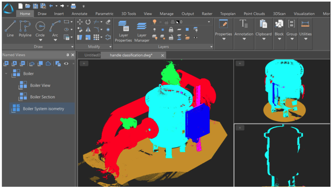
The new automatic registration tool also simplifies the alignment of separate scans. Users roughly position the point clouds, run the command, and nanoCAD 3DScan performs the final alignment.
Registration is an essential stage when information captured from different scanner positions must be combined into one consistent digital representation of a site, structure, or industrial facility.
Version 26 also introduces shared point-cloud storage. A dataset can be uploaded on one computer and made available to other connected workstations without creating multiple unnecessary copies.
This approach can improve revision management and reduce storage duplication when several specialists need to work with the same source data.
Another productivity improvement automatically fills the Segmentation panel with recognized aggregate shapes, including premises and pipeline systems.
By transferring detected geometry into the working structure, the software helps users move more quickly from raw scans to organized engineering information.
Main Capabilities
nanoCAD 3DScan is designed to turn large collections of measured points into practical models, drawings, calculations, and documentation. The software provides more than 150 commands covering major stages of scan-data processing.
Users can classify and segment point clouds, detect geometric features, create and edit meshes, compare scans with other clouds or models, and calculate areas and volumes.
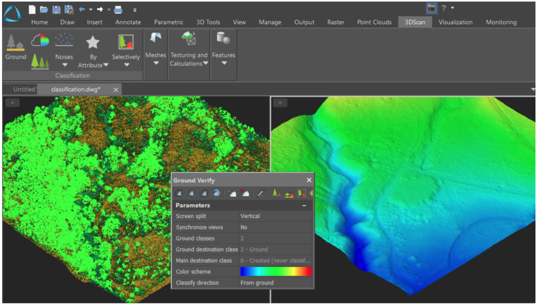
For surveyors and topographic specialists, the program can process airborne laser scanning data, create Digital Surface Models and Digital Elevation Models, produce topographic plans, and prepare information for geographic information systems.
Ground-classification and verification tools help separate terrain from other objects and refine results when automatic processing requires manual correction.
Construction and BIM teams can use point clouds to generate floor plans, recognize planes and contours, document existing conditions, and support the creation of as-built records and building models.
Layer-by-layer vectorization makes it possible to create sections at specified intervals and convert scan information into usable drawing data.
In industrial and infrastructure projects, the software can identify basic shapes such as planes, cylinders, spheres, cones, and tori. These functions support the recognition of pipes, structural elements, equipment, and other objects.
Engineers can also compare a point cloud with a design model to assess alignment, identify deviations, monitor technical condition, or document changes over time.
Languages, Licensing, and Availability
nanoCAD 3DScan 26 adds French, German, Portuguese, Korean, and Chinese interfaces. The expanded localization is intended to help teams in different regions use the same processing environment with fewer language barriers.
The release reflects the growing importance of combining terrestrial and aerial scanning in a unified engineering workflow.
Instead of treating a point cloud only as a visual reference, nanoCAD 3DScan allows specialists to analyze, classify, measure, model, and document real-world objects directly from captured data.
The software is available under workstation and network licensing options, and new users can evaluate the complete product through a 30-day trial.
For organizations working in surveying, construction, BIM, manufacturing, infrastructure, or condition monitoring, version 26 offers a more automated route from raw scan data to decisions and deliverables.